Jackson Blue Spring Cave System
Location: Jackson County, Florida, United States
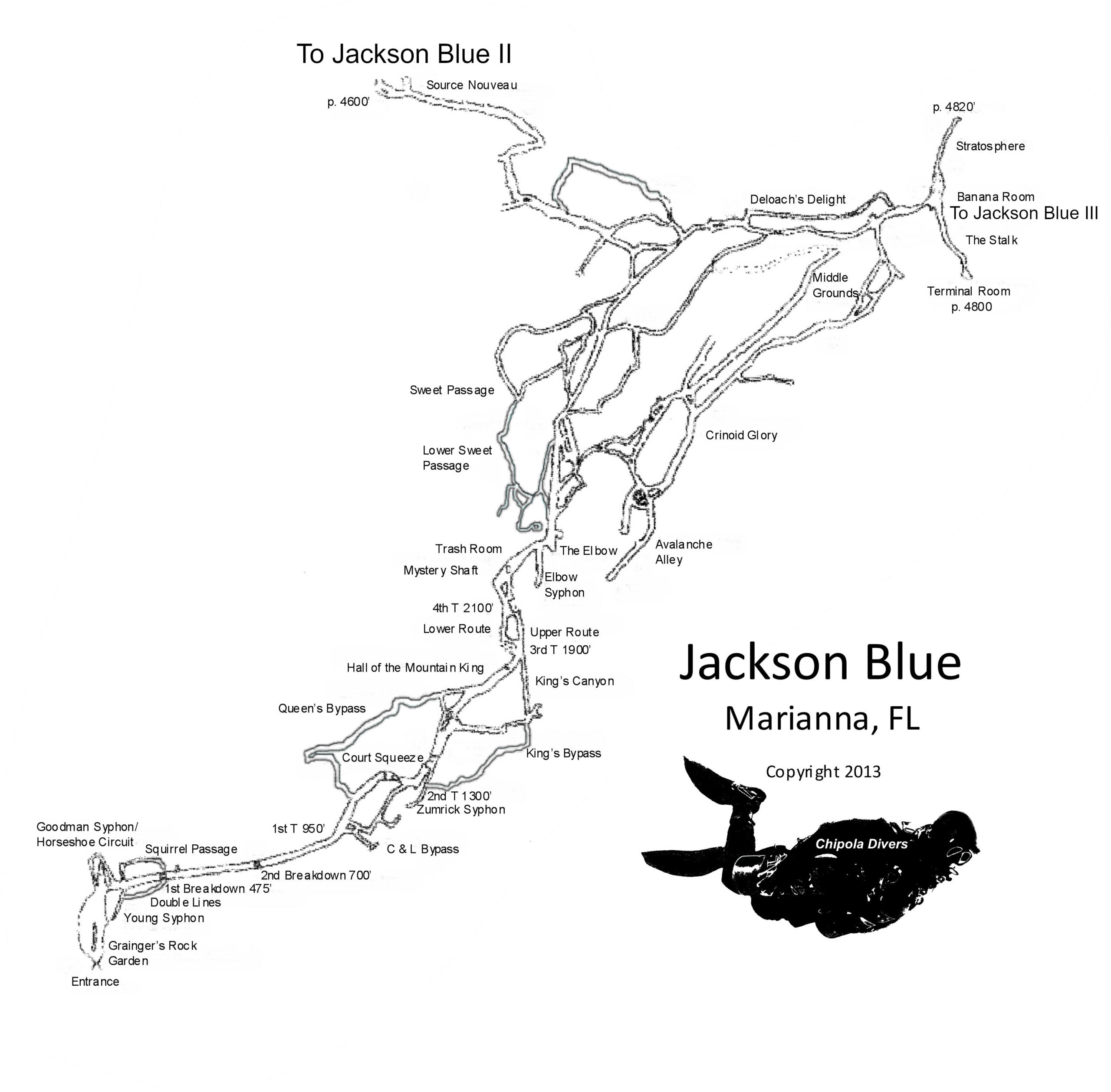
Jackson Blue Spring is the largest and most extensively explored cave system at Merritt’s Mill Pond in Marianna, Florida. The system extends approximately two miles from the main entrance and represents one of the most significant freshwater cave networks in North Florida.
What appears at the surface as a calm spring pool quickly transitions into an overhead environment where passage direction, flow, and sediment conditions must be managed with precision.
Jackson Blue is one of the defining cave systems of the Florida Panhandle and serves as a central reference point for understanding the region’s hydrology and structural development. For a broader overview of cave systems throughout the area, see the Guide to Cave Diving in the Florida Panhandle.
FREE FLORIDA SPRINGS GUIDE
Want to discover more of Florida’s hidden waterways?
Download The 25 Most Notable Springs and Cave Systems in Florida and explore some of the state’s most remarkable spring basins, underwater cave systems, and hidden natural treasures.
✓ Featured springs throughout Florida
✓ Cave systems and exploration highlights
✓ Popular destinations and hidden gems
✓ Instant download
Jackson Blue Spring can be reached by kayak, canoe, or paddleboard from Hunter Fish Camp boat launch in Marianna, Florida. You can also visit it through the Blue Spring Recreation Area park. There is an entry fee for the park. Depending on water levels and current conditions, paddlers can access the spring basin by following Merritt’s Mill Pond north for about 45-50 minutes. During warmer months, be attentive to motorized traffic on the pond. The route is generally suitable for recreational paddlers, though conditions may vary throughout the year.
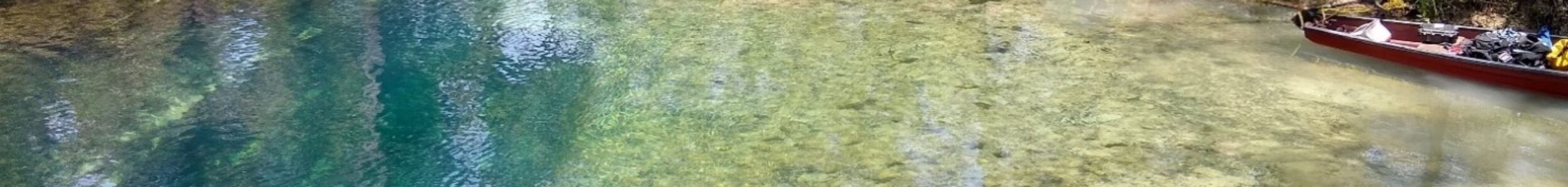
The spring is unmistakable. It is located beneath the concrete diving board platform at the northwest of the basin. The basin is separated from the pond by a floating dock and cable system. You can tie your vessel among the cypress trees near the east bank and swim through the break in the dock. You cannot step on land without paying the entry feet.
Paddlers may encounter limestone formations, submerged vents, native wildlife, and the clear blue water commonly associated with Florida’s spring systems. The spring provides a unique opportunity to observe the connection between Florida’s surface waterways and the hidden groundwater network flowing beneath the landscape.
Geological Context
Jackson Blue developed within Florida’s karst limestone, shaped by groundwater movement through fractures in the rock. The system is directly influenced by the Floridan Aquifer, and seasonal rainfall can affect both flow rate and visibility.
Because the cave formed below the water table, its passages are predominantly phreatic in origin – rounded and water-shaped rather than sharply angular. The structure reflects the steady dissolution process that gradually widened existing fissures into navigable tunnels.
Structure & Layout
The system consists of a primary main line with multiple side passages extending from it. Depth remains relatively moderate (80-99 feet / 24-30 meters) compared to some Florida systems, but flow conditions can vary depending on aquifer pressure and rainfall.
Large main corridors transition into smaller restrictions in certain sections. As with many Florida caves, visibility is highly dependent on sediment stability and diver movement. Minor contact with the floor can reduce clarity rapidly.
While significant portions of Jackson Blue have been mapped, exploration historically progressed incrementally through careful guideline extension and survey work.
Jackson Blue is an active limestone system subject to periodic collapse events.
- Strong aquifer-driven flow in certain conditions
- Wide main passage sections e
- Secondary side passages branching from the primary line
- Sediment-sensitive floor composition
- Seasonal variation in visibility and flow rate
Structural Collapses & Geological Change
Jackson Blue has experienced multiple documented structural collapse events over the past two decades, reflecting the dynamic nature of Florida’s karst limestone systems.
In 2008, while diving near Stage Rock, I encountered a substantial silt cloud extending approximately 150 feet before visibility improved. Upon my return 30 minutes later, sediment was still flowing out of the area and extended approximately 250 feet where it continued straight at the Elbow.
The disturbance originated from an area known as Avalanche Alley. No other divers were present in the cave at the time.
It is believed the silt was caused by a localized collapse within that section of passage, consistent with the character of the area.
A more detailed account of this event appears in The Hidden Rivers of Florida: Discoveries.
In 2011, a large section of ceiling collapsed approximately 250 feet inside the entrance, above the area known as the chimney fissure.
The primary collapsed block measured approximately 45 feet long, 25 feet wide, and 6 feet tall. Several additional large boulders fell to the cave floor during the same event.
On the morning prior to the collapse, an introductory cave class was conducting lost line drills in that area. No unusual indicators were present at that time.
When the collapse occurred, portions of the guideline were buried beneath fallen rock. The line was subsequently replaced to restore navigational continuity.
In 2014, a boulder fell directly in front of the Firehose Restriction, effectively blocking access to Jackson Blue 2 (see Exploration History below).
Immediately following the collapse, water flow throughout the system was noticeably reduced compared to conditions observed prior to the blockage.
Access to JB2 has remained restricted since that event.
These events highlight the dynamic nature of Jackson Blue. Despite its size and popularity, the system remains geologically active.
Collapses, flow changes, and structural evolution continue to shape the cave over time.
Exploration History
Jackson Blue has long been a focal point for Florida cave diving and exploration efforts. Over time, systematic mapping expanded the known length of the system through coordinated team dives and survey documentation.
Jackson Blue 2, commonly referred to as JB2, is a major downstream extension discovered by Marius Frei in the late 2000s.
The Freiway passage, approximately 800 feet in length, is low and restrictive. It was named the Freiway in honor of Marius Frei.
At the end of the Freiway, the cave continues toward a sinkhole located on private property more than one mile from the main spring opening. The passage proceeds through what became known as the Firehose Restriction, named for the force of water flow issuing from that section.
The discovery of Jackson Blue 2 extended the known cave to approximately two miles from the main entrance. Due to the combination of distance and depth, penetration into JB2 is technically demanding.
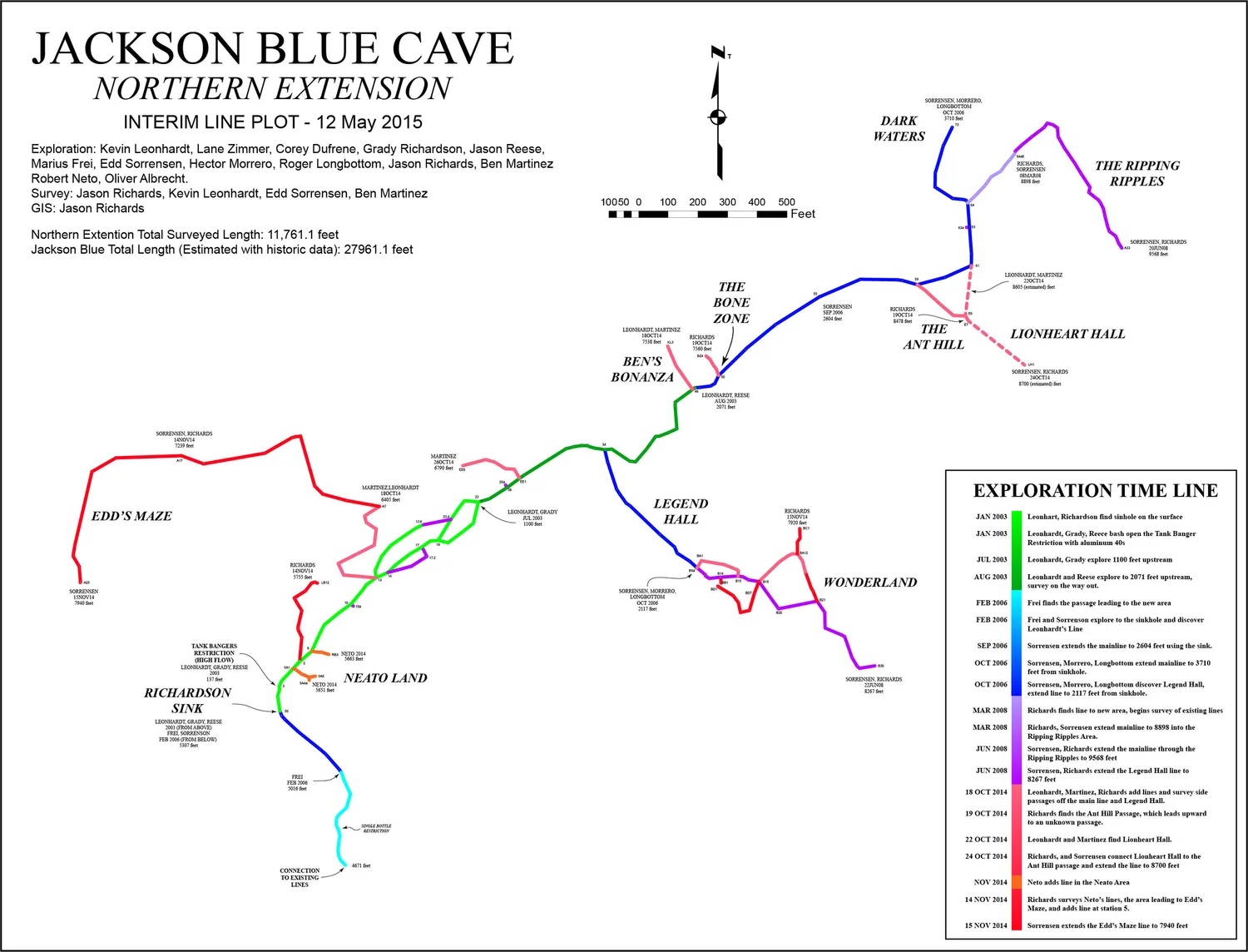
In the late 2010s, another previously undocumented section of the cave was discovered by Frank McNamara and designated Jackson Blue 3 (JB3).
While not as extensive as JB2, JB3 represents another significant extension within the system. As with JB2, the distance and depth involved make the area technically demanding.
Jackson Blue Spring remains one of the most technically demanding and extensively explored freshwater cave systems in the Florida Panhandle.
Mapping & Documentation
Mapping within Jackson Blue follows standard cave survey methodology: distance measurement, compass heading, and depth recording. Survey data contributes to broader system documentation and helps maintain continuity between mapped sections.
Although much of the primary structure is documented, cave systems of this nature always require continued verification and maintenance of existing guideline infrastructure.
Portions of this cave system were explored and surveyed during cave dives conducted by Rob Neto while documenting Florida’s underwater cave systems for the book The Hidden Rivers of Florida.
Cave Data
Jackson Blue Spring is a first magnitude spring with significant flow. During droughts, the flow can diminish to low flow status, but most of the time, you will work to move through the cave.
When entering the cave, stay close to the right wall to avoid the flow. At the restriction between the Deco Room and the Rock Garden, get low and move to the right as soon as you are through. You’ll notice a sand path along the right wall. Stay a foot or so above that as you make your way to the beginning of the gold line. The sand is there because there’s not much flow, so you’ll be able to easily swim without making contact with the cave. Once you reach the line, stay to the right of it and slightly below until you reach the shelf just after the restriction to Young’s Siphon. Then move to the left of it but continue to stay low.
At the bottom of the chimney fissure, once you get past the duck under, ascend to the ceiling and stay high and to the right. This will keep you mostly out of the current. Continue staying as far to the right of the line as comfortable until you reach the first gold line T.
Current Status
- River conditions may influence visibility near the entrance.
- county managed property surrounding the basin
- variable depth profiles
- restrictive sidemount-only sections
- known collapses over the past 2 decades
This system is discussed in The Hidden Rivers of Florida because of its importance to cave exploration and ground water research.
Learn about the bookFrequently Asked Questions
The spring is located at the head of Merritt’s Mill Pond just outside of Marianna, Florida. It can be accessed by boat and through the Blue Spring Recreation Area.
Trained and certified cavern and cave divers can dive inside of the cave within the limits of their training. The spring basin is less than 10 feet deep other than directly at the opening, where it reaches a depth of about 14 feet, so it is not suitable for recreational divers.
Yes, you can launch at the Hunter Fish Camp boat launch located about 2.5 miles downstream from the spring. You cannot paddle directly to the spring because there is a floating dock across the basin. However, you can secure your kayak to a cypress tree and swim under the cable to the spring opening. The land surrounding the basin is owned by the state and managed by the county. You must pay an entry fee to step on land.
The spring basin averages about 6 feet of depth. At the opening, it is about 14 feet deep. The cave reaches a maximum depth of 99 feet and has an average depth of about 80 feet.
Yes, you can visit the spring through the Blue Spring Recreation Area. There is a small per person fee to enter. You can also visit the spring by water by launching from Hunter Fish Camp boat launch.
The cave is an independent system that is not connected to any other springs. However, over the past 15 years, discoveries have been made that have extended the cave far beyond the initial exploration of it back in the 80s. What was once thought to be an independent system accessed at Richardson Sink, is now a second opening to the cave. Richardson Sink is located on private property and access through there is not allowed.
Continue Exploring Florida’s Hidden Waters
If you enjoyed the information about this springs, you’ll love the free guide:
The 25 Most Notable Springs and Cave Systems in Florida
From world-famous destinations like Wakulla, Jackson Blue Spring, and Peacock Springs to lesser-known hidden gems, this guide introduces some of Florida’s most fascinating natural wonders.
Download your free copy and continue exploring beyond the surface.
Get the Free Guide →Nearby Springs
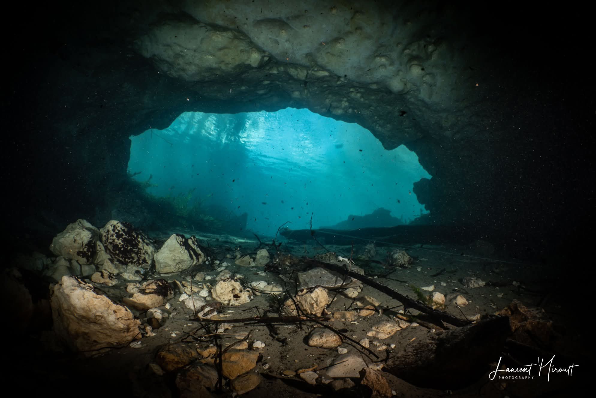
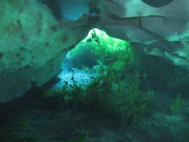
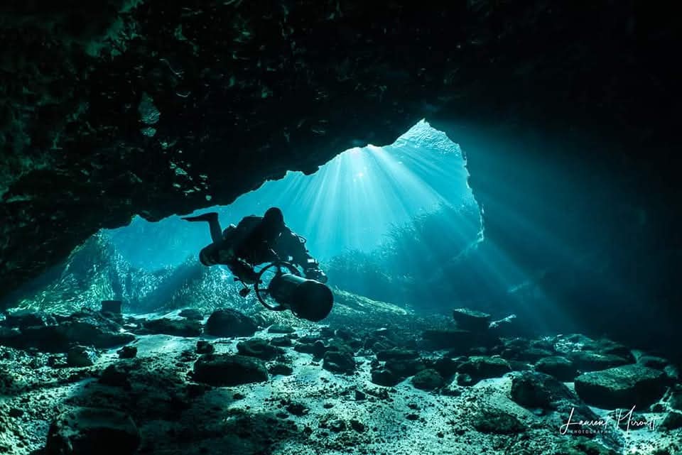
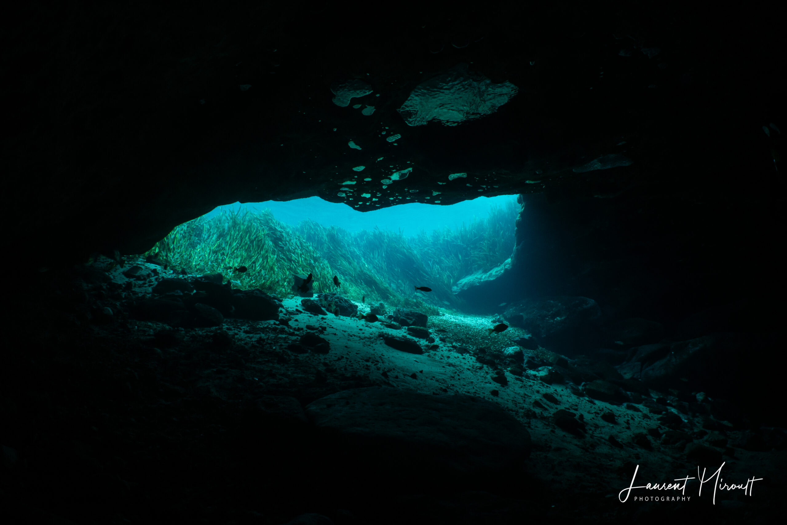
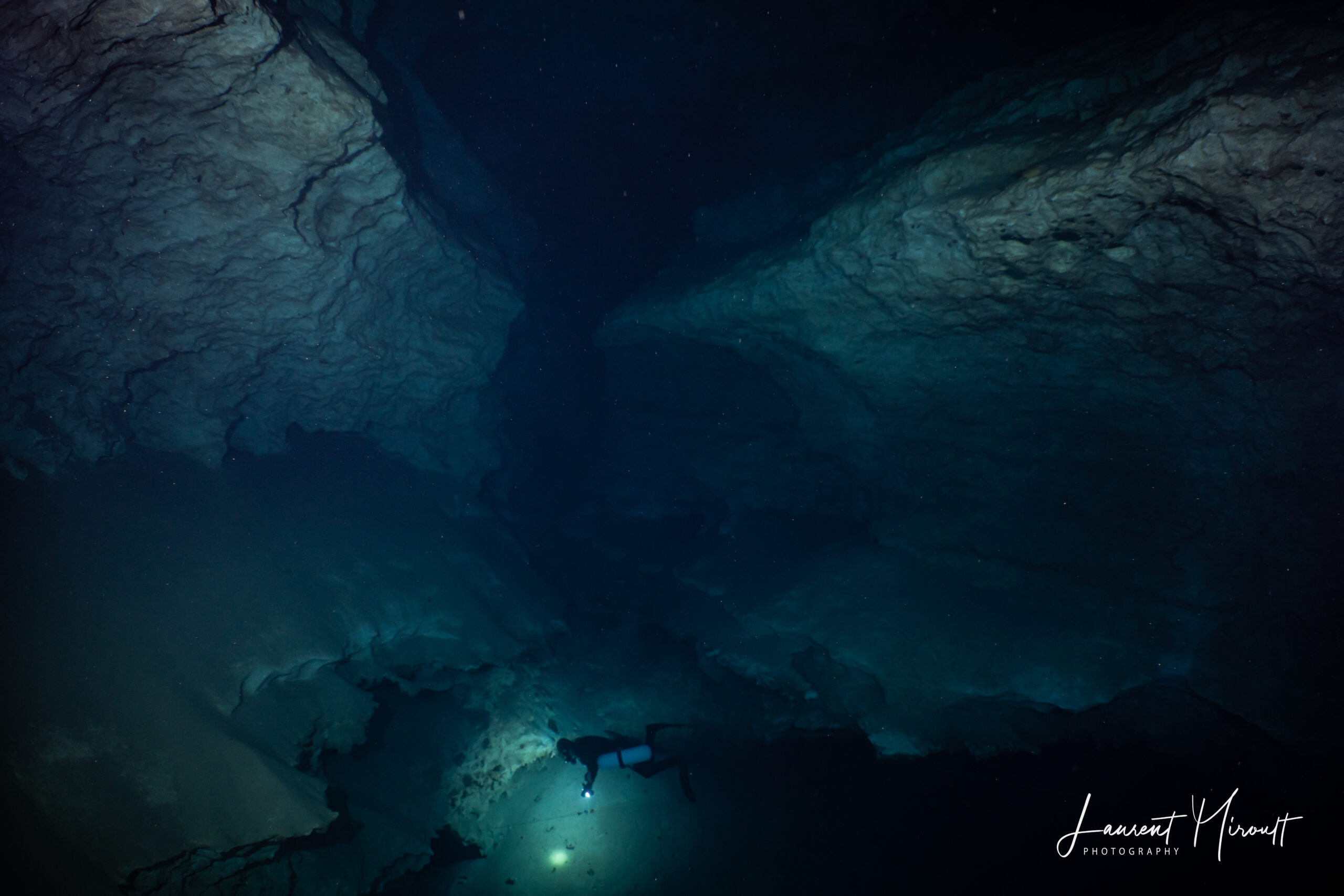
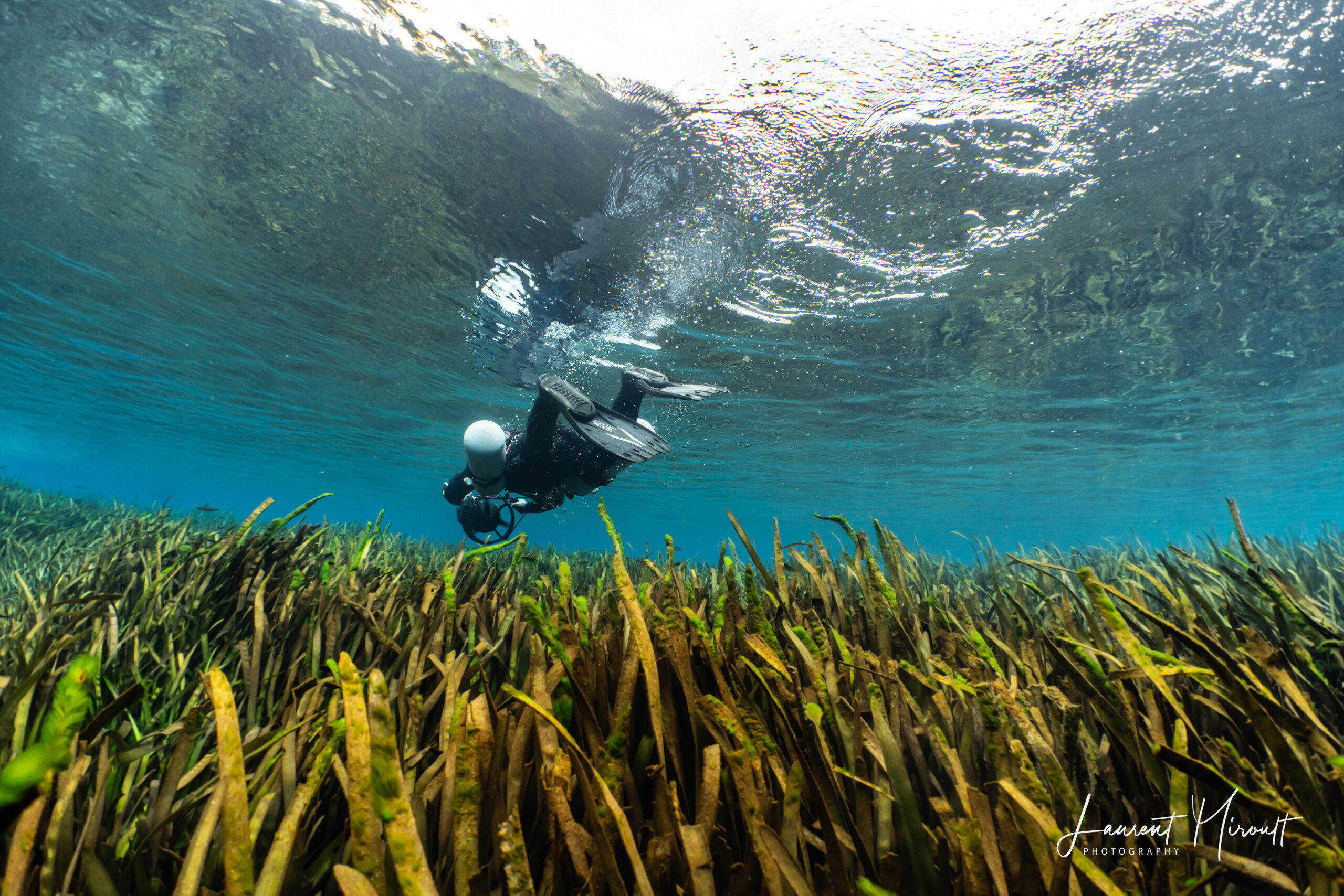
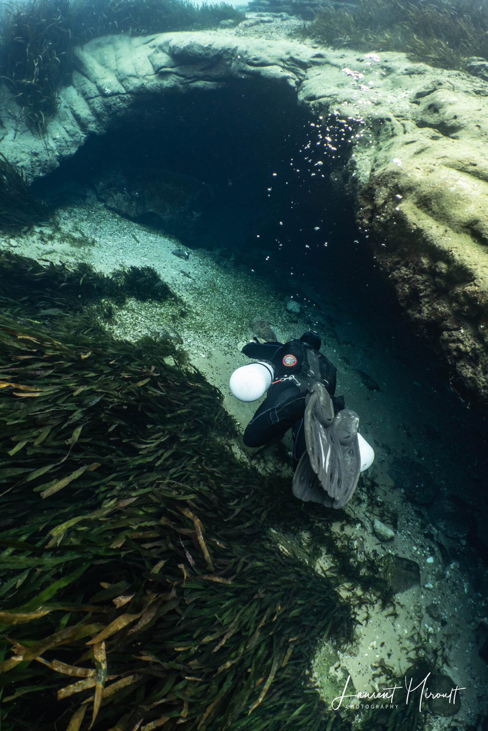
Photo Gallery
The following images were taken in Jackson Blue by Laurent Miroult. These are areas described in Discoveries.
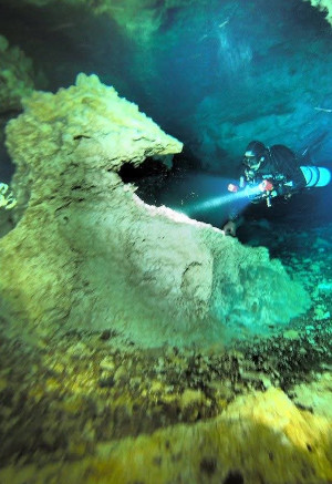

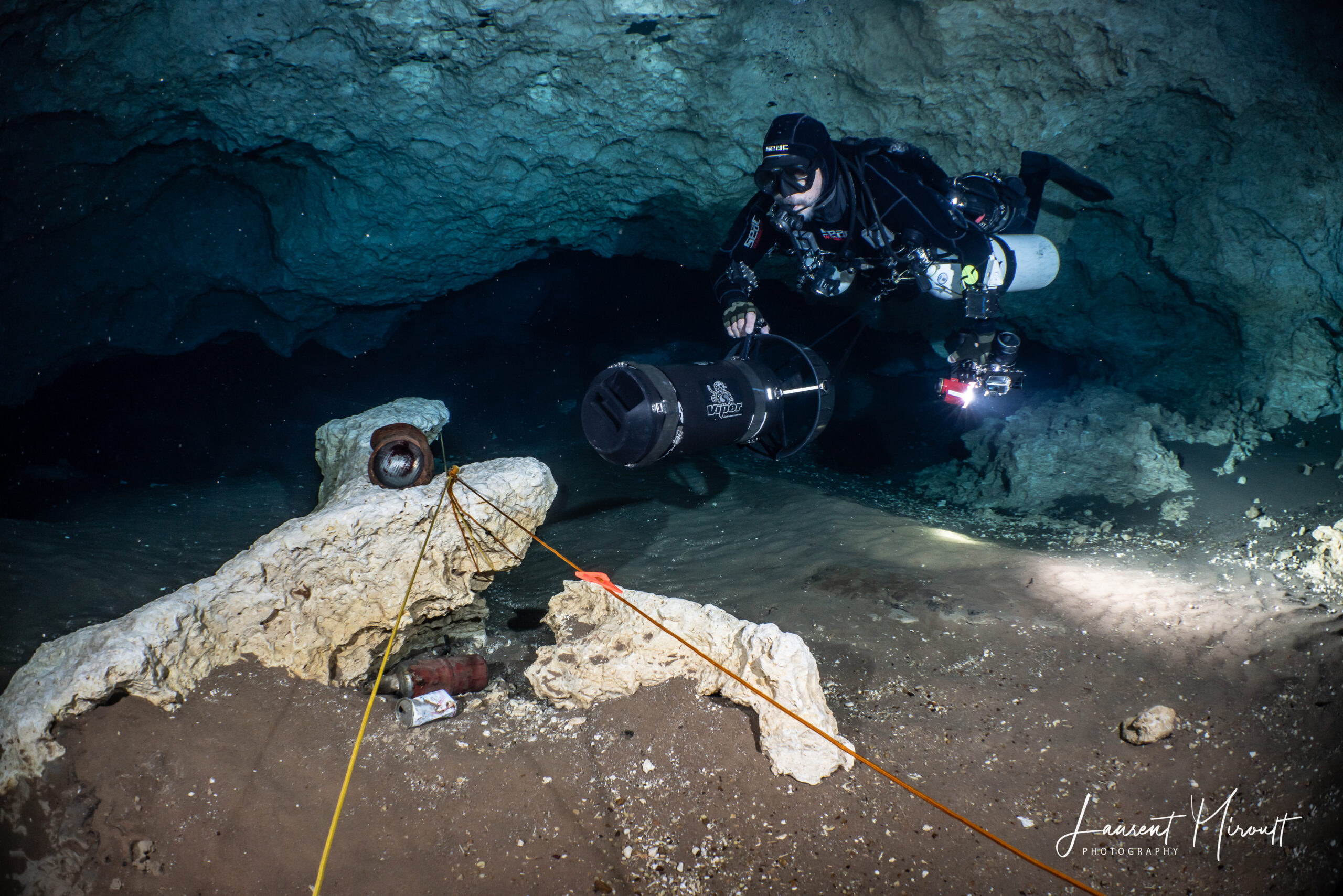
For more photos by Laurent Miroult, please visit cavediving.pictures