Maps of Cave Systems in the Florida Panhandle
Florida is one of the largest concentrations of underwater cave systems in the world. There are hundreds of documented springs located through central and north Florida and the Florida panhandle. These springs formed tens of thousands of years ago. They now provide access to underwater cave systems formed within its limestone bedrock. Many caves are hidden along the rivers and deep in the forests. Most are accessible through spring openings and sinkholes.
Many of these systems have been explored and surveyed by cave divers over several decades.
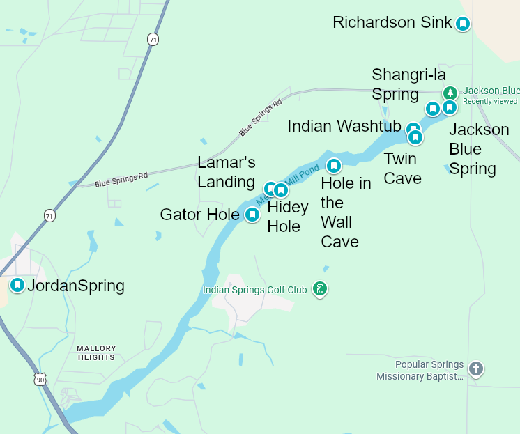
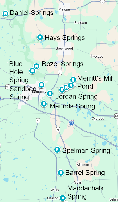
Below are maps that show approximate locations of several of the cave systems that have been explored in the Florida panhandle.
Merritt’s Mill Pond
Chipola River Basin
Choctawhatchee River Basin
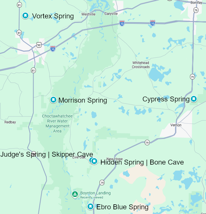
Cave Systems on above Maps
Jackson Blue Spring Cave System
Hole in the Wall cave system
Twin Cave system
Bozel Spring (Baltzell Spring)
Maddachalk Spring
Maunds Spring
Ebro Blue Spring
Hidden Spring / Bone Cave
Judge’s Spring / Skipper Cave
Cypress Spring
Morrison Spring
Please visit the individual spring/cave system pages to view available maps of the hidden rivers.