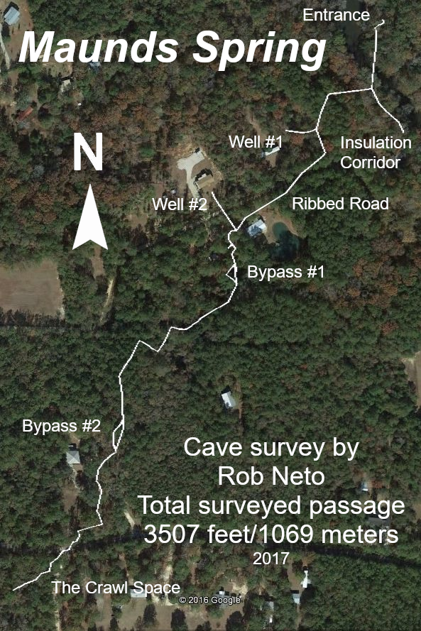
Maunds Spring
Location: Jackson County, Florida, United States
Maunds Spring within the Chipola River basin of the Florida Panhandle, known for its clear water, flowing limestone passage, and distinctive submerged karst formations.
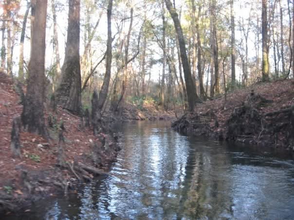
Maunds Spring is located less than one mile from the Hinson Preserve primitive boat launch along the Chipola River.
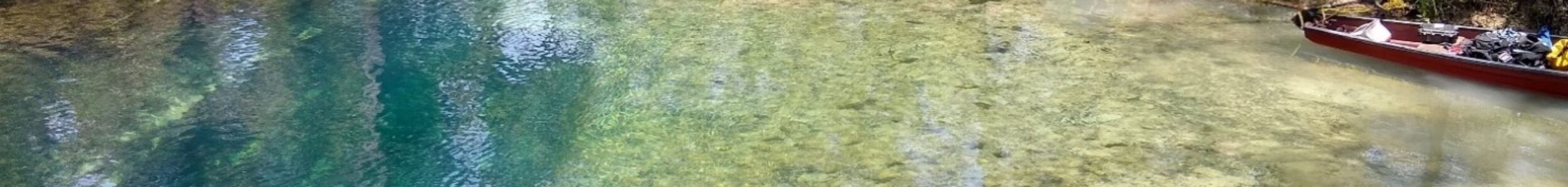
The spring sits in a scenic basin at the end of a short spring run that empties directly into the river. The entrance to the cave lies at the bottom of the basin in a vertical fissure crack.
Maunds is known for its frequent fissure cracks along the main passage, distinctive organic-coated passage known as Insulation Corridor, and moderate overall length of approximately 3,500 feet of surveyed passage.
FREE FLORIDA SPRINGS GUIDE
Want to discover more of Florida’s hidden waterways?
Download The 25 Most Notable Springs and Cave Systems in Florida and explore some of the state’s most remarkable spring basins, underwater cave systems, and hidden natural treasures.
✓ Featured springs throughout Florida
✓ Cave systems and exploration highlights
✓ Popular destinations and hidden gems
✓ Instant download
Maunds Spring can be reached by kayak, canoe, or paddleboard from the primitive boat launch in Hinson Conservation and Recreation Area located in Marianna, Florida or from the Magnolia boat launch south of I-10. Depending on water levels and current conditions, paddlers can access the spring basin by following the Chipola River south for about 15 minutes from Hinson or north from Magnolia for about 5 miles. You will encounter shoals along the southern route. The route is generally suitable for recreational paddlers, though conditions may vary throughout the year.
As you approach the spring, watch for changes in water color, clarity, and vegetation that often indicate groundwater entering the system. The spring run is located on the east bank of the river and is easily identifiable by the confluence of the clear spring water and the tannic river water. Paddlers may encounter limestone formations, submerged vents, native wildlife, and the clear blue water commonly associated with Florida’s spring systems. The spring provides a unique opportunity to observe the connection between Florida’s surface waterways and the hidden groundwater network flowing beneath the landscape.
Geological Context
Maunds Spring emerges from Florida’s karst limestone aquifer system within the Chipola River basin of the Florida Panhandle.
The cave developed through dissolution of submerged limestone, forming a structurally varied passage system characterized by flow-sculpted walls, breakdown features, and sediment deposits.
Like many regional springs, the system reflects the hydrological behavior typical of northern Florida karst environments where groundwater movement and river interaction strongly influence cave conditions.
Structure & Layout
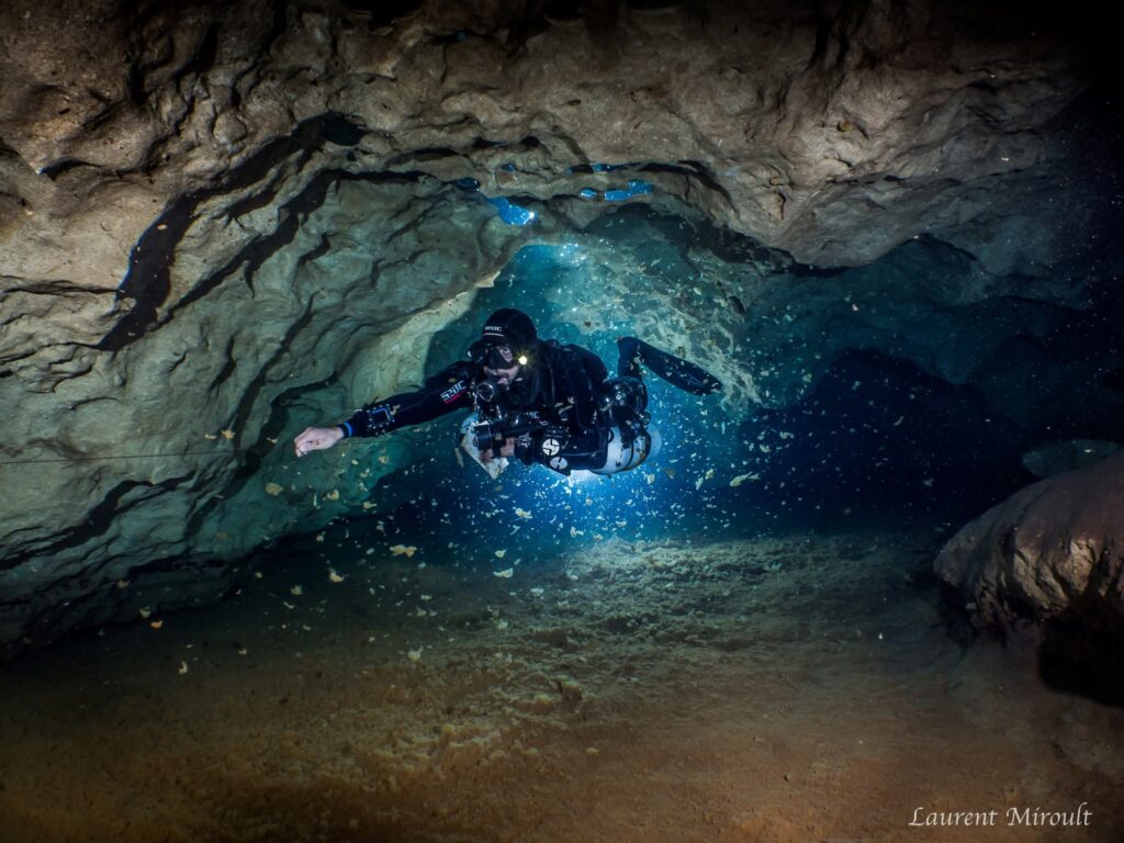
Maunds Spring consists primarily of a main underwater passage with several changes in elevation and flow direction throughout the system.
The cave contains a mixture of wider rooms, sculpted limestone corridors, and more confined sections that require careful positioning and buoyancy control.
Flow remains present through much of the system and contributes to the clean appearance of the limestone walls and sediment patterns.
Hydrological Characteristics
Maunds Spring is known for maintaining relatively clear water conditions throughout much of the year.
Visibility can still fluctuate following major rainfall events and elevated river stages, though conditions often stabilize quickly compared to nearby systems.
Sustained groundwater discharge creates noticeable flow throughout portions of the cave system.
- Flow strength may vary seasonally.
- Current is typically strongest near constricted sections.
- River levels can influence entrance visibility and downstream conditions.
Delicate limestone formations and unconsolidated sediment deposits require careful propulsion and buoyancy control throughout the system.
Insulation Corridor
Insulation Corridor is characterized by an unusual organic material coating portions of the floor, walls, and ceiling.
The material resembles blown attic insulation and can accumulate to depths approaching one foot in certain sections.
This corridor presents a visually distinct environment compared to the rest of the cave system and requires careful propulsion to avoid disturbing accumulated material.
Exploration & Survey History
In the mid-2010s, survey efforts extended the end of the line by approximately 250 feet, identifying previously undocumented passage.
A comprehensive survey and updated map were completed during this period, bringing the total documented length of Maunds Spring to approximately 3,500 feet.
These efforts improved understanding of the cave’s branching structure and overall layout.
Cave Data
The opening to Maunds Spring can be a bit tricky. It is located about 40 feet deep at the bottom of a narrow fissure. It’s often choked in by debris from the trees surrounding the spring basin. While the opening is not that small, it can appear to be so due to this.
Once inside the cavern, the depth drops to about 60 feet, and at the bottom, you’ll encounter a low restriction that requires sidemount to continue through. The floor is solid limestone with small pieces of gravel, so you won’t disturb the visibility. On the other side of the restriction, you’ll see a wine bottle sitting up in the silt. Shortly after that, you’ll see insulation-like material start to appear on the floor. At the line intersection, the line to the left goes into Insulation Corridor. Visibility will be diminished quite a bit on the way out of this tunnel due to percolation of the insulation matter.
The main line continues to the right. As you swim through the main passage, you’ll see fissures perpendicular to the passage every hundred feet or so. They don’t go very far, so it’s not worth running line into them. There are a couple of Ts to the right which don’t go very far. There are also a couple of short loops that are worth checking out. The end of the line is in a very low passage more than 3000 feet from the opening.
Current Status
Maunds Spring remains an active spring cave system within the Chipola River watershed and continues to be recognized for its geological structure and stable groundwater flow.
- River conditions may influence visibility near the entrance.
- Flow conditions can vary throughout the system.
- Careful buoyancy control is required in fragile limestone areas.
- Some sections contain uneven breakdown and sediment deposits.
The system’s layout combines manageable penetration distances with technical considerations at both the entrance and interior restrictions.
This system is discussed in The Hidden Rivers of Florida because of its importance to cave exploration and ground water research.
Learn about the bookFrequently Asked Questions
The spring is located a short paddle from the primitive launch located at Hinson Conservation and Recreation Area in Marianna, Florida.
Yes, it’s about a 20 minute paddle downriver along the Chipola River from the Hinson Conservation and Recreation Area. While you’re there, head upriver so you can explore the Ovens, as well.
The fissure in the spring basin is 40 feet deep. Once inside the cave, the depth drops to the 60s and remains there for most of the dive. It gets shallower as you get closer to the end of the line.
Continue Exploring Florida’s Hidden Waters
If you enjoyed the information about this springs, you’ll love the free guide:
The 25 Most Notable Springs and Cave Systems in Florida
From world-famous destinations like Wakulla, Jackson Blue Spring, and Peacock Springs to lesser-known hidden gems, this guide introduces some of Florida’s most fascinating natural wonders.
Download your free copy and continue exploring beyond the surface.
Get the Free Guide →Nearby Springs
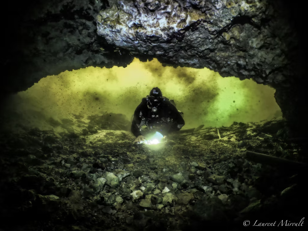
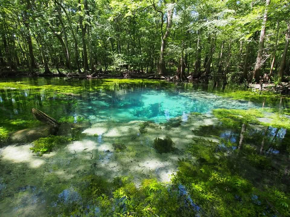
Photo Gallery
The following images were taken in Maunds Spring Cave System by Laurent Miroult.
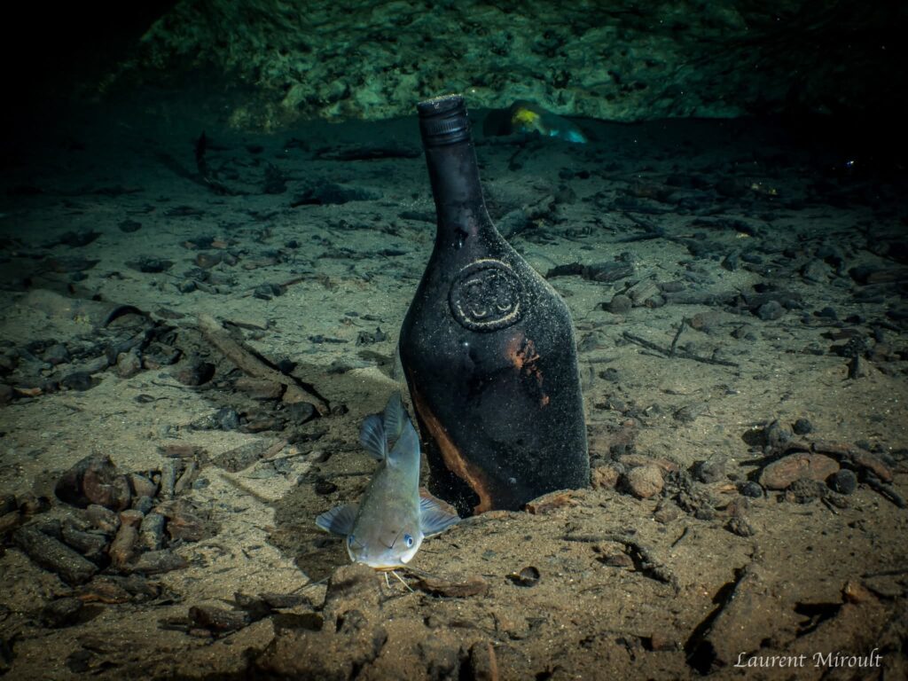
For more photos by Laurent Miroult, please visit cavediving.pictures