Hole in the Wall Cave System
Location: Jackson County, Florida, United States
Hole in the Wall is one of the longest documented cave systems within Merritt’s Mill Pond in Marianna, Florida. Although officially measured at more than four miles in surveyed passage, it is widely believed that adjacent systems such as Jackson Blue may ultimately prove longer.
Hole in the Wall is also historically notable within Florida cave diving circles as the location of one of Sheck Exley’s documented long-distance penetrations.
FREE FLORIDA SPRINGS GUIDE
Want to discover more of Florida’s hidden waterways?
Download The 25 Most Notable Springs and Cave Systems in Florida and explore some of the state’s most remarkable spring basins, underwater cave systems, and hidden natural treasures.
✓ Featured springs throughout Florida
✓ Cave systems and exploration highlights
✓ Popular destinations and hidden gems
✓ Instant download
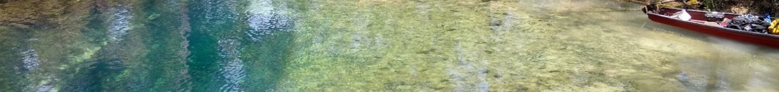
Hole in the Wall Spring can be reached by kayak, canoe, or paddleboard from Hunter Fish Camp boat launch in Marianna, Florida. Depending on water levels and current conditions, paddlers can access the spring by following Merritt’s Mill Pond north for about 20-25 minutes. During warmer months, be attentive to motorized traffic on the pond. The route is generally suitable for recreational paddlers, though conditions may vary throughout the year.
The spring is on the east bank and is easily located by looking for the first dock nestled among cypress trees and not attached to the bank. The dock is for public use, so you can tie up and climb onto it. Please be mindful of others, particularly cave divers, that may be using it.
The spring opening is located directly behind the dock. You’ll see an opening on the bank about 5 feet above the water’s surface. This is just a small alcove that does not connect to the hidden river beneath it. If you’re lucky, you might see a bat or two fly out of it. The spring opening is about 5 feet below the surface directly beneath the opening on land.
Paddlers may encounter limestone formations, submerged vents, native wildlife, and the clear blue water commonly associated with Florida’s spring systems. The spring provides a unique opportunity to observe the connection between Florida’s surface waterways and the hidden groundwater network flowing beneath the landscape.
Geological Context
Hole in the Wall is the longest documented cave system within Merritt’s Mill Pond and one of the longest in the immediate region. Although it currently holds that distinction, it is believed that neighboring Jackson Blue may ultimately prove longer as exploration and survey efforts continue.
Unlike the other cave systems in the pond, Hole in the Wall historically experiences seasonal environmental changes during the winter months. Water clarity often becomes milky, and temperatures drop several degrees. This phenomenon is unique among the Merritt’s Mill Pond systems. The presence of a golf course above portions of the cave’s passages has been suggested as a contributing factor, although the precise hydrological cause remains subject to interpretation.
The system formed within Florida’s karst limestone and remains directly influenced by aquifer behavior, which likely plays a role in its seasonal variability.
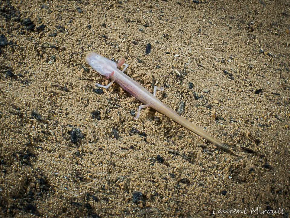
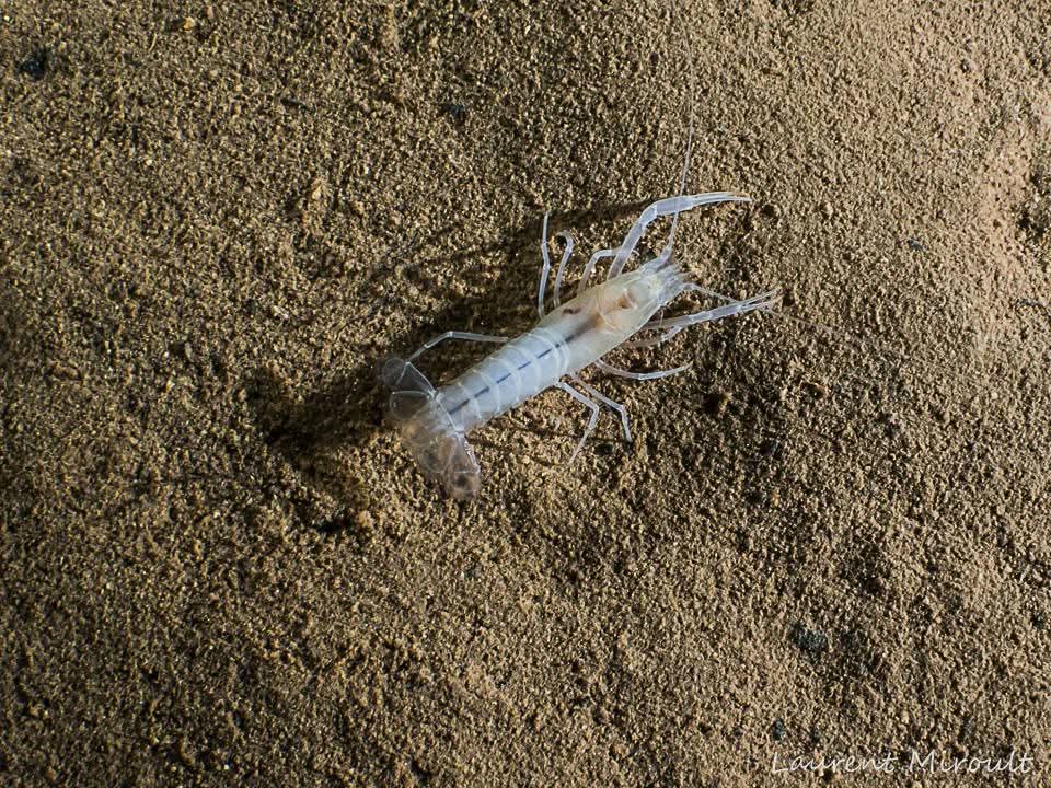
Cave Fauna: Blind Salamanders and Crayfish
Hole in the Wall Cave is home to several species that have adapted to life in the perpetual darkness of the underwater cave environment. Among the most notable are the blind albino salamander, often referred to as the Georgia blind salamander, and a species of blind albino crayfish.
These animals are examples of troglobitic cave fauna, organisms that have evolved specifically to live in cave systems. Over long periods of time in complete darkness, these species have lost pigmentation and functional eyesight. Instead, they rely on heightened sensory organs to detect movement and changes in water flow within the cave.
The salamanders and crayfish observed in Hole in the Wall Cave display the typical characteristics of cave-adapted species: pale coloration, reduced or absent eyes, and slow movement through the water or along the cave floor. These animals are rarely encountered outside cave environments and are considered important indicators of the fragile ecosystems that exist within submerged cave systems. Similar species are also found in nearby cave systems such as Twin Cave System, highlighting the biological connections between caves within the Merritt’s Mill Pond region.
Encounters with these species serve as a reminder that Florida’s underwater caves are not only geological formations but also unique biological habitats supporting specialized life forms that exist nowhere else.
Structure & Layout
Approximately 80 feet inside the entrance, the cave divides into two primary branches commonly referred to as “upstream” and “downstream.” These names do not reflect the actual direction of water flow.
The terminology is believed to have developed because it is not uncommon for one branch to temporarily overpower the other, creating the impression that water is siphoning from one side for the first several hundred feet. This effect occurs because both branches are significantly larger than the passage through which they ultimately converge before exiting into the pond.
The resulting hydraulic interaction can produce noticeable directional shifts in flow within the initial sections of the system.
Hydrological Characteristics
Hole in the Wall is unique among Merritt’s Mill Pond systems in that it historically experiences reduced winter visibility. During colder months, water clarity may become milky and temperatures can drop several degrees compared to other springs in the pond.
The presence of a gold course above portions of the cave has been considered a possible contributing factor, though direct causation has not been formally established.
Exploration History
Renewed exploration efforts in the 2010s significantly expanded understanding of the system. Swiss cave diver Marius Frei, who spent significant time exploring Florida cave systems, identified multiple passage continuations and expanded the documented footprint of the cave.
Among his notable discoveries were a chamber named the “Trash Room” due to the presence of trash from a sinkhole that once existed above it and an extended shallow passage that continued for thousands of feet. In portions of this extension, the profile becomes shallow enough that decompression stops are required before continuing further exploration.
Following Marius Frei’s discoveries in the 2010s, I explored several of the areas he had identified and extended portions of his established lines after discussions regarding his exploration work. One significant extension involved a line trending in the direction of Indian Washtub. The passage now terminates within approximately 200 feet of the known passages of that system, suggesting a potential hydrological relationship between the two caves, though no confirmed physical connection has been established. In addition, I discovered and extended a low-profile passage branching from one of the routes leading toward the Trash Room. This passage extends more than 500 feet beyond previously documented sections. These extensions contributed to a more complete understanding of the system’s layout and its potential connectivity within Merritt’s Mill Pond. These extensions contributed to the current surveyed length exceeding four miles of documented passage.
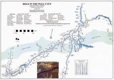
Additional survey work was incorporated into updated mapping efforts, including a revised map produced by Jason Richards. This documentation placed the system at more than four miles in length, though some explored areas were not fully represented in that iteration.
As with many Florida cave systems, mapping and verification remain ongoing processes.
Hole in the Wall has played a significant role in the evolution of long-distance cave exploration in the Florida Panhandle. Its history is best understood within the broader context of regional cave development outlined in the Guide to Cave Diving in the Florida Panhandle.
Survey work in Hole in the Wall follows established cave mapping protocols, including distance, compass heading, and depth recording. Continued documentation ensures system data remains accurate as environmental conditions shift over time.
Hole in the Wall and other Merritt’s Mill Pond systems are referenced in The Hidden Rivers of Florida, where the mindset and preparation required for navigating Florida’s spring-fed caves are explored in greater detail.
Portions of this cave system were explored and surveyed during cave dives conducted by Rob Neto while documenting Florida’s underwater cave systems for the book The Hidden Rivers of Florida.
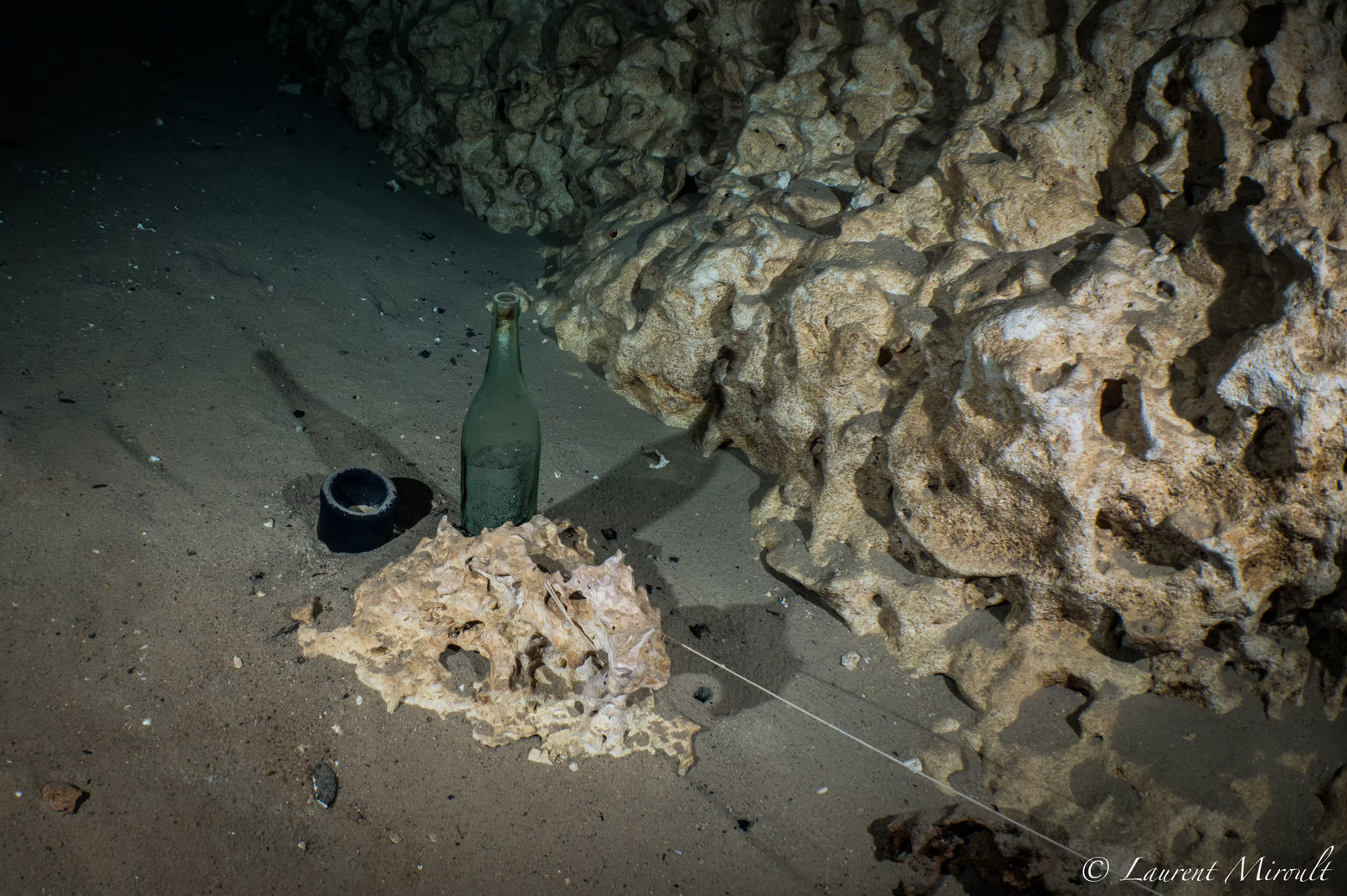
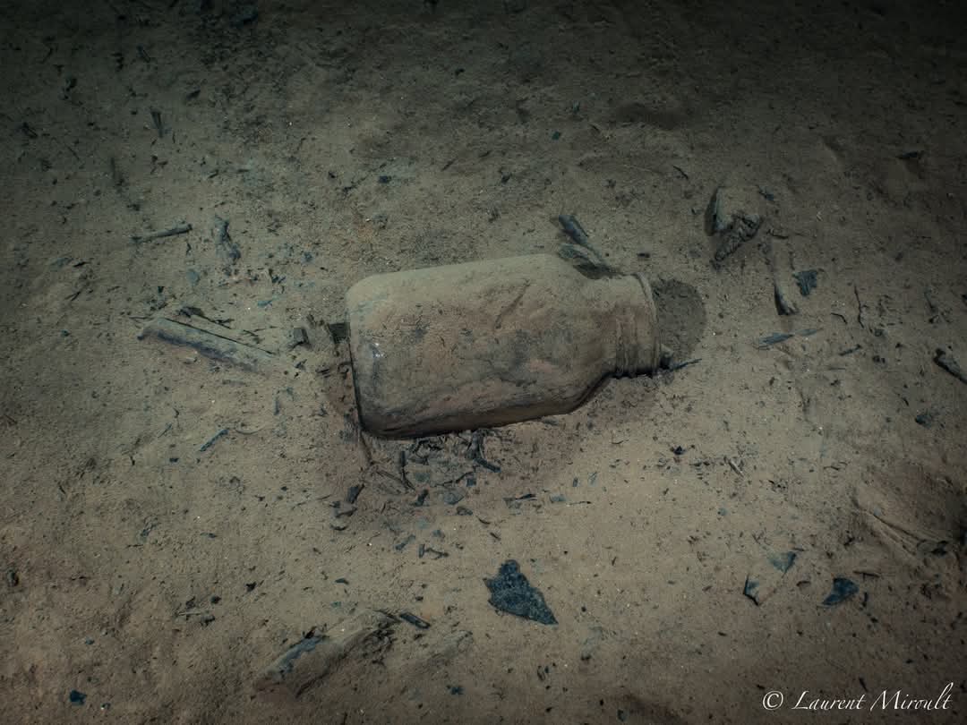
Historic Milestone – The Exley Champagne Bottle
At the end of the upstream passage, approximately 5,000 feet from the main entrance, lies a champagne bottle placed by pioneering cave diver Sheck Exley.
When Exley reached this location and placed the bottle, it represented a significant achievement given the equipment, gas management practices, and limited decompression modeling available at the time. The dive marked one of the notable long-distance penetrations of its era and remains a quiet historical landmark within the system.
The bottle continues to serve as a reminder of early technical cave exploration in Florida.
Hole in the Wall remains one of the most extensive and hydrologically complex cave systems within Merritt’s Mill Pond, with potential proximity to neighboring systems suggesting ongoing geological connectivity.
- Defined entrance within Merritt’s Mill Pond
- Moderate depth profile
- Sections of variable passage width
- restrictive sidemount-only sections
- known collapses over the past 2 decades
- Sediment-sensitive floor composition
- Aquifer-influenced flow conditions
- Home to the Blind Albino Salamandar and Blind Albino Crayfish
Cave Data
Hole in the Wall is a low flow system, however, you will feel the current until you reach the chimney about 80 feet from the opening. This is because there are two large passages emptying water into Merritt’s Mill Pond through this small tunnel.
At the bottom of the chimney, you can head towards 11 o’clock to take the downstream passage or towards 2 o’clock to take the upstream passage. These are misnomers. Both passages spring. However, oftentimes, the current from one passage overpowers the current from the other passage and it will feel like one is siphoning for the first 300 feet or so. This is minimal and temporary.
The upstream passage leads you toward the Alford’s Room and the Century Tunnel T about 1200 feet from the opening. The Century Tunnel is a smaller passage about 100 feet deep and will eventually get you to Sheck Exley’s champagne bottle, located almost 5,000 feet from the opening.
The downstream passage leads you toward the Big “E”, located 700 feet from the opening. Consolation Corridor is also located at the third T, about 2200 feet from the opening. Consolation Corridor is always clear, no matter how bad the visibility is in the rest of the cave.
Current Status
- water conditions in the cave
- boat access only
- variable depth profiles
- restrictive sidemount-only sections
This system is discussed in The Hidden Rivers of Florida because of its importance to cave exploration and ground water research.
Learn about the bookFrequently Asked Questions
The spring is located on Merritt’s Mill Pond about a mile north of Hunter Fish Camp boat launch. It is on the east bank behind a dock nestled among cypress trees. The dock is not connected to the bank.
Trained and certified cavern and cave divers can dive inside of the cave within the limits of their training. The cavern is small and does not offer much for cavern divers to see. The cave is the second longest system in the area.
Yes, you can launch at the Hunter Fish Camp boat launch and head north on Merritt’s Mill Pond. Look for the first dock on the east bank that is not attached to land.
The maximum depth of the cave is just over 100 feet. The average depth is 80 feet.
The cave is an independent system that is not connected to any other springs. However, there are some passages in the cave that are in close proximity to Twin Cave and Indian Washtub and it is believed that there is a hydrological connection between the 3 systems.
Continue Exploring Florida’s Hidden Waters
If you enjoyed the information about this springs, you’ll love the free guide:
The 25 Most Notable Springs and Cave Systems in Florida
From world-famous destinations like Wakulla, Jackson Blue Spring, and Peacock Springs to lesser-known hidden gems, this guide introduces some of Florida’s most fascinating natural wonders.
Download your free copy and continue exploring beyond the surface.
Get the Free Guide →Nearby Springs
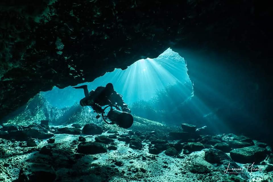
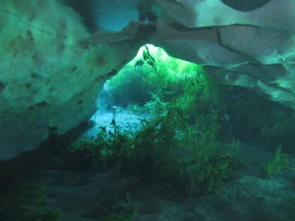
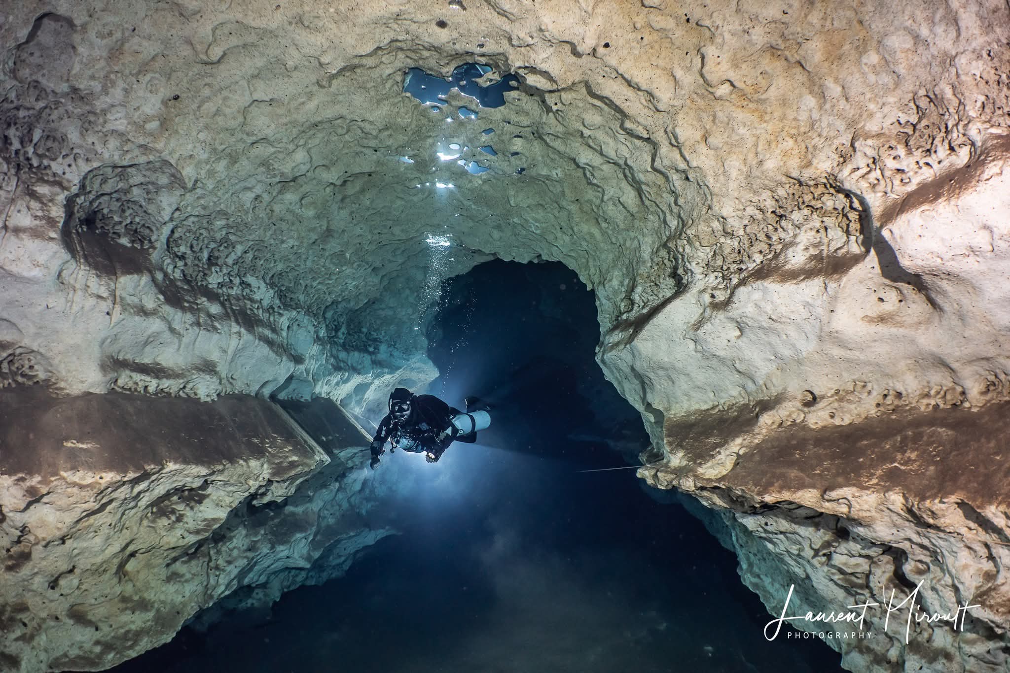
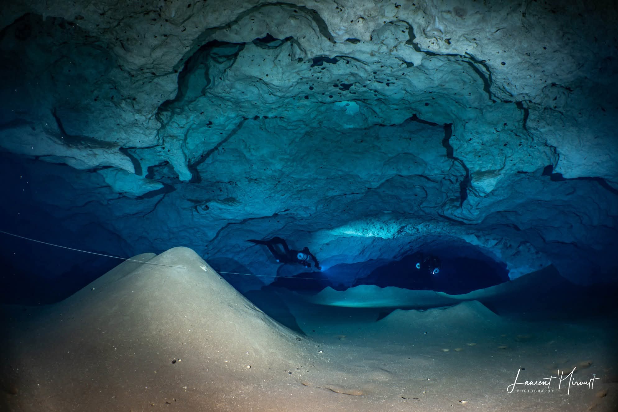
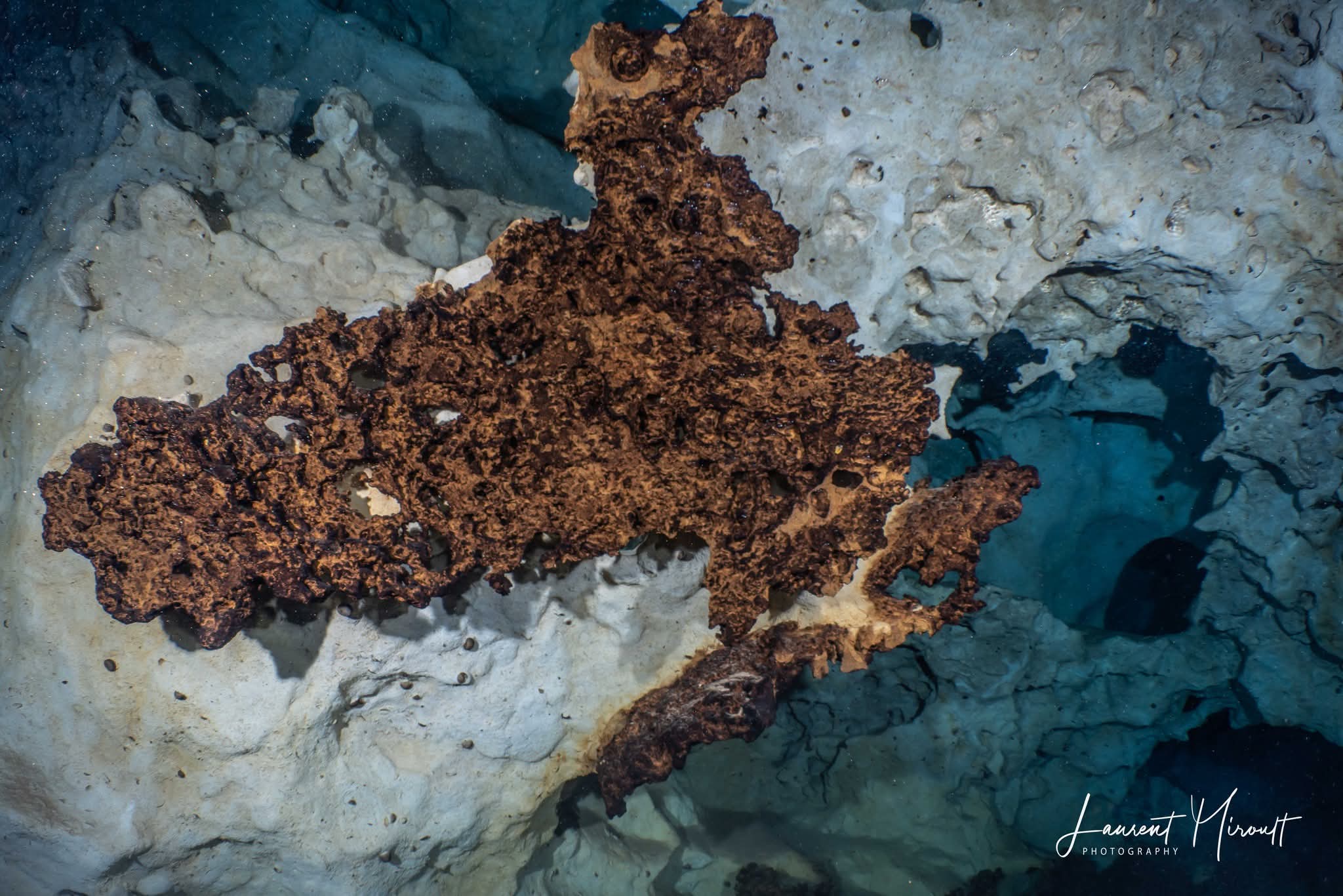
Photo Gallery
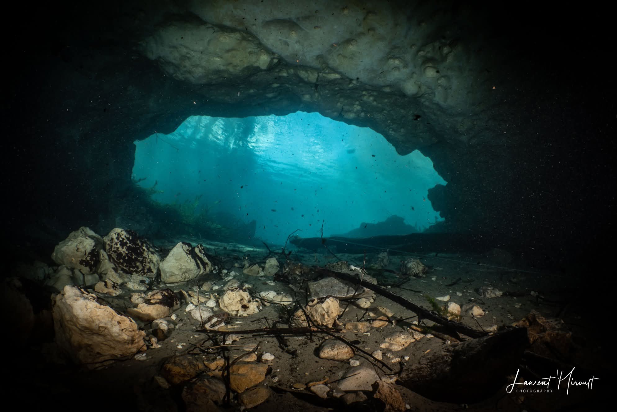
The following images were taken in Hole in the Wall Cave System by Laurent Miroult.
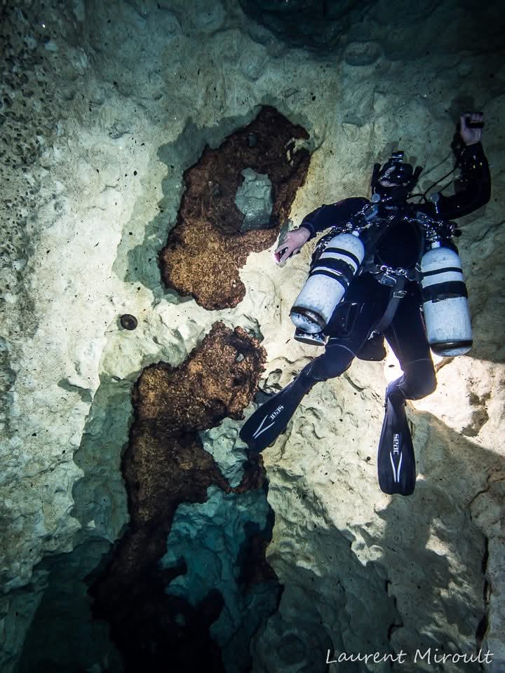
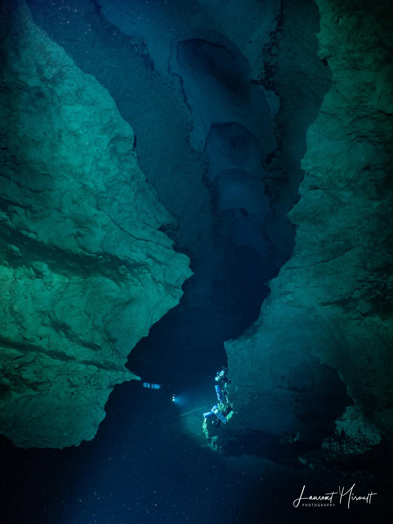
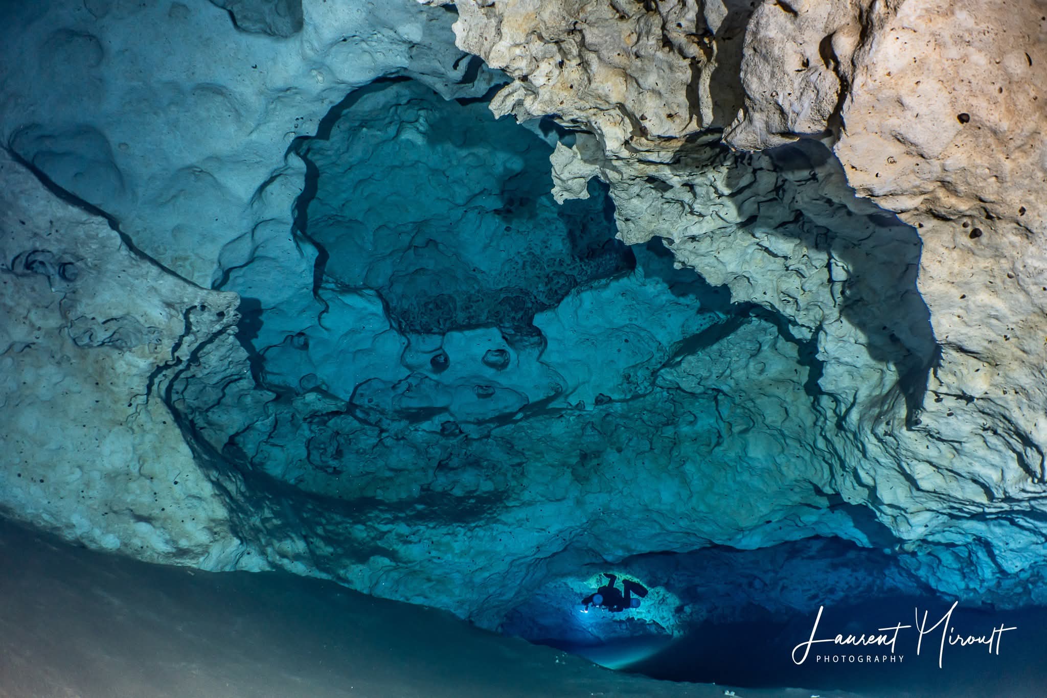
For more photos by Laurent Miroult, please visit cavediving.pictures