Woodville Karst Plain
Overview
The Woodville Karst Plain contains some of the largest and most extensively explored underwater cave systems in North America. Located south of Tallahassee and extending toward the Gulf of Mexico, the region is characterized by sinkholes, springs, disappearing streams, and vast underground conduits that transport groundwater through the Floridan Aquifer.
Unlike many of Florida’s spring systems, the Woodville Karst Plain functions as a highly interconnected groundwater network. Numerous springs, sinks, and karst windows provide access to portions of a cave system that extends for many miles beneath forests, wetlands, and rural landscapes.
The region has played a central role in cave exploration, hydrogeological research, and the development of modern cave-diving techniques. Today, it remains one of the most significant karst regions in the world.
The area hosts the Wakulla–Leon Sinks cave system, recognized as the longest surveyed underwater cave in the United States and one of the most important submerged karst systems in the world.
Geological Context
The Big Bend Area sits atop highly soluble limestone associated with the Floridan Aquifer. Over geological time, slightly acidic groundwater enlarged fractures and bedding planes within the limestone, gradually forming extensive submerged cave systems beneath the region.
- Underground rivers
- Sinkhole collapses
- Spring vents
- Multi-level cave passages
- Large dissolution chambers
- Long-distance submerged conduits
Structural collapse remains an active geological process throughout the region, continuously reshaping portions of the cave systems over time.
Because of the region’s relatively low elevation and proximity to the Gulf Coast, some systems also exhibit tidal influence and groundwater mixing zones.
Wakulla Basin
The Wakulla Basin represents one of the most hydrologically significant karst regions in Florida and contains numerous springs, sinks, and interconnected submerged passages.
- Wakulla Springs
- Sally Ward Spring
- Emerald Sink
- Turner Sink
- Leon Sinks
- Indian Springs
- Lost Creek
- Chip’s Hole
- Guy Revell Sink
- Harvey Sink
- Church Sink
Wakulla-Leon Sinks Cave System
The Wakulla–Leon Sinks cave system is recognized as the longest surveyed underwater cave in the United States.
The system contains extensive submerged passage connecting multiple sinkholes, springs, and groundwater conduits across the Wakulla Basin. Exploration and survey efforts have documented many miles of underwater passage, though portions of the system remain unexplored.
- Cave diving exploration
- Underwater cartography
- Karst hydrology research
- Aquifer studies
- Geological documentation
Major Cave Systems and Springs
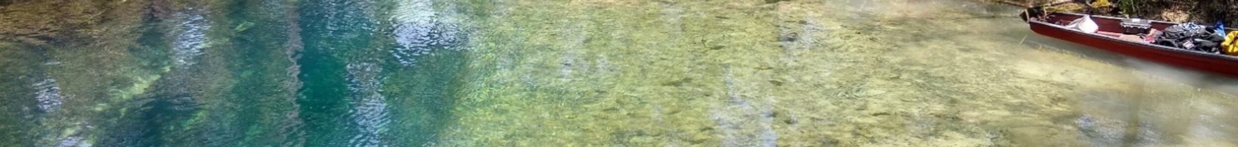
Wakulla Springs
Wakulla Springs is one of the largest and deepest freshwater springs in the world. The spring serves as the primary discharge point for an extensive cave system that has been explored for decades and continues to reveal new passages and connections.
The Wakulla system has played a pivotal role in cave-diving exploration and groundwater research.
Sally Ward Spring
Sally Ward Spring is connected to the broader Woodville Karst Plain groundwater network and serves as an important component of the region’s hydrology. Exploration has helped document its relationship to neighboring cave systems and recharge features.
Emerald Sink
Emerald Sink is one of the most significant recharge points within the Woodville Karst Plain. Surface water entering the sink contributes to the groundwater flow that ultimately feeds major spring systems throughout the region.
Turner Sink
Turner Sink provides access to a portion of the region’s underground drainage network and has been an important site for cave exploration and hydrological study. The sink illustrates the direct interaction between surface water and groundwater within the karst plain.
Leon Sinks
Leon Sinks Geological Area contains numerous sinkholes, swallets, and karst windows that provide insight into the processes shaping the Woodville Karst Plain. Many of these features are directly connected to the underlying groundwater system.
Indian Springs
Indian Springs is a spring and cave system connected to the broader groundwater network of the Woodville Karst Plain. The site contributes to understanding groundwater flow and karst development throughout the region.
Lost Creek
Lost Creek is a disappearing stream that vanishes underground before becoming part of the region’s extensive groundwater network. Dye-tracing studies have demonstrated connections between Lost Creek and major springs within the Woodville Karst Plain.
Chip’s Hole
Chip’s Hole provides access to portions of the underwater cave system associated with the Woodville Karst Plain. The site has contributed to exploration efforts and continues to provide insight into groundwater movement beneath the region.
Guy Revell Sink
Guy Revell Sink is an important karst feature that serves as both a recharge point and exploration site. Its connection to the broader groundwater system highlights the interconnected nature of the Woodville Karst Plain.
Harvey Sink
Harvey Sink is another significant recharge feature within the region. Water entering the sink becomes part of the extensive conduit system that characterizes the Woodville Karst Plain.
Church Sink
Church Sink provides access to the underground drainage network and serves as an example of the sinkhole development that defines much of the region’s surface landscape.
Black Creek Rise
Black Creek Rise represents a major groundwater discharge feature within the Woodville Karst Plain. The rise demonstrates the movement of water through the region’s underground conduits and provides valuable insight into groundwater flow patterns.
Exploration History
The Woodviulle Karst Plain has played a central role in the history of Florida cave diving and underwater exploration.
Beginning in the mid-20th century and accelerating through the 1970s and 1980s, divers expanded exploration efforts throughout the Wakulla Basin and surrounding spring systems using improved equipment, mixed-gas techniques, and underwater survey methods.
Numerous discoveries within the region have contributed to a broader understanding of karst development and aquifer dynamics throughout Florida.
The area continues to attract explorers, researchers, and cave divers from around the world.
- Cave mapping
- Long-distance penetration techniques
- Underwater survey standards
- Aquifer research
- Geological documentation
Hydrology
The hydrology of the Woodville Karst Plain is among the most complex in Florida. Surface water, groundwater, springs, sinkholes, and disappearing streams interact through an interconnected network of conduits beneath the surface.
Dye tracing, cave surveys, and scientific research have revealed numerous connections between recharge features such as Lost Creek, Emerald Sink, Harvey Sink, and major discharge points including Wakulla Spring and Black Creek Rise.
These connections provide valuable insight into groundwater movement and aquifer function throughout the region.
Ecological Importance
The springs, sinks, and groundwater systems of the Woodville Karst Plain support diverse ecosystems that depend upon clean groundwater and stable spring flow.
These habitats provide important resources for aquatic species while contributing to the overall ecological health of the region.
The protection of groundwater resources remains critical to maintaining the integrity of these systems.
Hydrological Significance
The Big Bend cave systems represent major discharge points for the Floridan Aquifer and play a critical role in groundwater transport throughout North Florida.
- River flow
- Wetland systems
- Groundwater recharge
- Water clarity
- Coastal hydrology