North Florida Cave Systems
Overview
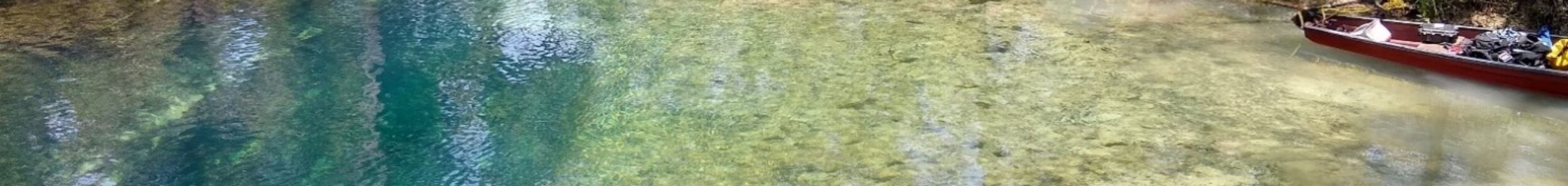
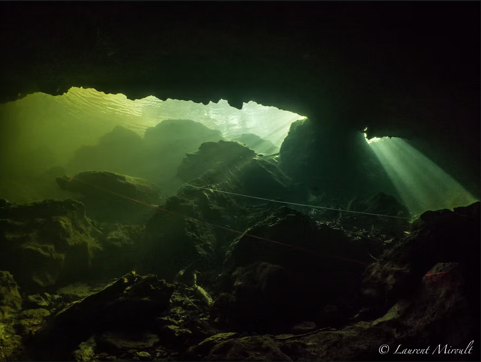
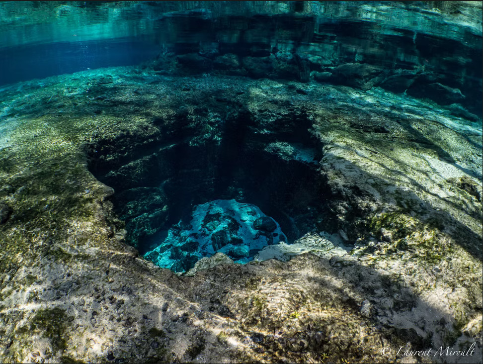
North Florida contains one of the highest concentrations of freshwater spring cave systems in the world. Formed within the limestone of the Floridan Aquifer, these systems range from high-flow spring vents and river sink systems to extensive underwater cave networks that extend for miles beneath the surface.
The region’s caves are shaped by geology, groundwater movement, and decades of exploration. Understanding these systems requires examining both the springs visible on the surface and the hidden rivers flowing through the limestone below.
This section documents cave systems within three primary regions:
Each basin exhibits distinct hydrological behavior, structural characteristics, and exploration history.
Geological Foundations of North Florida Cave Systems
The cave systems of North Florida developed within the Floridan Aquifer, a vast limestone formation that underlies much of the southeastern United States.
Over thousands of years, slightly acidic groundwater dissolved the limestone, creating conduits that evolved into spring-fed cave systems. Many of today’s major springs discharge millions of gallons of groundwater each day.
- First-magnitude springs
- Extensive underwater cave systems
- Reiver sink and river rise systems
- Multi-entrance cave networks
- Sinkholes and karst windows
Major Cave Diving Regions in North Florida
Suwannee River Basin
Encompasses 15 Florida counties
The Suwannee River Basin contains many of Florida’s most recognized cave-diving destinations.
- Peacock Springs
- Madison Blue Spring
- Manatee Blue Spring
- Little River Spring
- Cow Spring
- Telford Spring
- Lafayette Blue Spring
- Convict Spring
- Royal Spring
- Pot Spring
- Luraville Spring
- Bonnet Spring
- Troy Spring
Several of these systems provide access to extensive cave networks and interconnected groundwater pathways beneath the basin.
Explore detailed documentation of the Suwannee River Basin
Santa Fe River Basin
The Santa Fe River Basin contains one of the highest concentrations of springs and underwater cave systems in Florida. The basin is known for the Santa Fe River’s disappearance underground at O’Leno State Park and reemergence at River Rise.
- Ginnie Springs
- Devil’s Cave System (The Eye & the Ear)
- Hornsby Spring
- Poe Spring
- Rum Island
- Blue Spring
Explore Santa Fe River Basin cave systems
Withlacoochee River Basin
The Withlacoochee River Basin contains a diverse collection of spring caves and groundwater conduits. Madison Blue Spring remains one of Florida’s premier cave-diving destinations, while Eagle’s Nest is recognized worldwide as one of the most technically demanding underwater cave systems.
- Eagle’s Nest
- Weeki Wachee Springs
- School Sink
- Hardee Spring
- Twin Dees
- Diepolder Systems
- Weeki Wachee
- Citrus Blue Hole
- Gum Slough Springs
- Annutteliga Hammock Systems
The basin continues to contribute to exploration, groundwater studies, and cave-diving history.
Explore Withlacoochee River Basin cave systems
Woodville Karst Plain
The Woodville Karst Plain contains some of Florida’s largest and most significant underwater cave systems. Wakulla Spring, Leon Sinks, Lost Creek, Chip’s Hole, Turner Sink, Sally Ward Spring, and numerous sinkholes are connected through an extensive groundwater network that ultimately drains toward the Gulf of Mexico.
- Wakulla Springs
- Sally Ward Spring
- Emerald Sink
- Turner Sink
- Leon Sinks
- Indian Springs
- Lost Creek
- Chip’s Hole
- Guy Revell Sink
- Harvey Sink
- Church Sink
- Emerald Sink
- Black Creek Rise
The region remains one of the most important cave-exploration areas in North America.
Explore the Woodville Karst Plain
Types of Cave Systems Found in North Florida
Many springs discharge large volumes of groundwater through extensive conduit networks. Examples include Madison Blue Spring, Peacock Springs, and Ginnie Springs.
Some waterways disappear underground and later reemerge. The Santa Fe River provides one of Florida’s best-known examples.
Several cave systems contain multiple spring and sink entrances connected through shared underground conduits. Lafayette Blue Spring and Green Sink illustrate this type of karst development.
Certain caves, most notably Eagle’s Nest and portions of the Wakulla system, require advanced technical diving and specialized equipment.
Hydrology and Groundwater Flow
Groundwater movement throughout North Florida is controlled by the Floridan Aquifer and the limestone formations through which it flows.
Dye tracing, cave surveys, and hydrogeological studies have demonstrated connections between springs, sinkholes, and river systems separated by miles on the surface.
These hidden rivers influence water quality, spring discharge, and ecosystem health throughout the region.
Historical Significance of North Florida Cave Diving
North Florida played a major role in the development of modern cave diving.
Many of the techniques, procedures, and exploration methods used today were refined within the springs and cave systems of the Suwannee, Santa Fe, Withlacoochee, and Woodville regions.
Decades of survey work have documented hundreds of miles of underwater cave passage, yet significant portions of the underground drainage network remain unexplored.
Exploration and Documentation
Modern exploration combines survey techniques, underwater photography, geology, hydrology, and digital mapping to document these complex cave systems.
Advances in sidemount diving, rebreathers, DPVs, and mapping technology continue to improve understanding of North Florida’s hidden rivers.
The process of documenting these systems remains ongoing as new passages and connections continue to be discovered.
Environmental Considerations
North Florida’s springs and cave systems are environmentally sensitive resources.
Changes in groundwater quality, recharge rates, land use, and spring discharge can affect both cave systems and the ecosystems they support.
Responsible exploration, scientific research, and conservation efforts help preserve these unique environments for future generations.
Current Status
North Florida’s cave systems remain dynamic and hydrologically active. Water level fluctuations, sediment movement, structural collapse, and groundwater flow continue to shape the underground landscape throughout the region.
Exploration and survey efforts have documented hundreds of miles of underwater cave passage within the Suwannee River Basin, Santa Fe River Basin, Withlacoochee River Basin, and Woodville Karst Plain. Despite decades of exploration, many systems remain only partially surveyed, and new discoveries continue to expand understanding of Florida’s hidden groundwater networks.
Advances in mapping technology, underwater photography, and cave-diving equipment continue to improve documentation of these complex systems. At the same time, ongoing scientific research provides valuable insight into groundwater movement, aquifer dynamics, and the geological processes that continue to shape North Florida’s caves today.
Related Resources
For detailed documentation of individual cave regions:
Featured in Hidden Rivers of Florida
The exploration of many Florida cave systems and the stories behind these discoveries are documented in the book Hidden Rivers of Florida. The book describes the exploration history, challenges, and discoveries made by cave divers working to map these submerged passages.